|
|
|
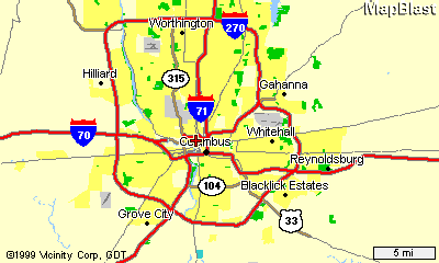
Map of Columbus & directions from Columbus airport to Nationwide Plaza. 1. The Columbus International Airport is in the N.E., the grey area at the N.E. part of the I-270 outerbelt close to Gahanna. Nationwide Plaza is marked exactly where the Columbus label is at the center of I-270 outerbelt. Please see the next map for more details. From the airport, take I-670 West to downtown Columbus.
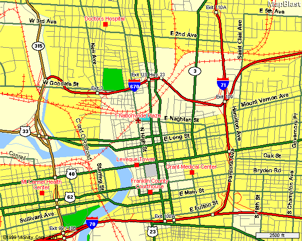
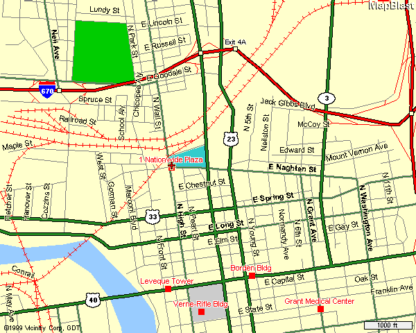
2. From I-670, you can exit either at US Hwy 23 which is High street or Fourth street, which is parallel to High street but a couple of blocks East of it.
3. You should now be a few blocks North or North East of Nationwide Plaza at the north-end of the Convention Center. Just drive down or South on High street a few blocks until you reach Nationwide Boulevard. Nationwide Plaza I is at the S.W. corner of the intersection of High street & Nationwide Blvd.. The Nationwide garage is West of it on Front street.
|